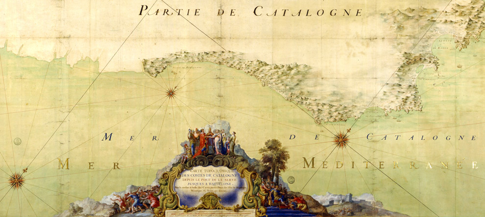
Extract of the maps produced by Charles Pène, hydrographic engineer to the King of France, Louis XIV in 1680.
The Maps and Plans Department of the National Library of France was founded in 1828, under the impulse of Edme-François Jomard, a former engineer-surveyor on the Egyptian expedition.
The Maps and Plans Department works on the assignment of acquiring, preserving and communicating geographical atlases and maps, plans and globes covering the entire world.
The original fund of the Department, regularly enriched by donations and acquisitions, is representative of engraved European production from the 16th to the 19th centuries, and contains most of the French publications. Its collections contribute to making it one of the richest collections of maps in the world. The following are worthy of mention:
- • 160 globes of the earth and the universe (16th-20th centuries);
- • approximately 500 portulans, nautical charts on vellum, representative of the cartographic schools from the 13th to the 18th centuries;
- scientific objects: sundials, astrolabes, including the oldest Arabic astrolabe known, dating back to the 10th century;
- • wall maps including rare documents like Sebastien Cabot's world map, or that of Gerard Mercator;
- • 135,000 photographs [including 40,000 glass plates] including a major collection concerning French expeditions in Sub-Saharan Africa at the end of the 19th century;
- • 150,000 manuscripts including that of 20,000 Leagues under the Sea by Jules Verne, and many travel journals.
The Department, which regularly restores its funds to preserve its collections, wants to restore a map in colours entitled "The Coasts of Catalonia", plotted by Charles Pène, a hydrographic engineer from the times of the King Louis XIV in 1680. This is a hand drawn watercolour map comprising several canvas sheets measuring 193 cm in width for a heioght of 82 cm. This large format is typical of the supports used for interior paintings by Vermeer of Delft. The work would involve dusting, stopping tears and reinforcing the fragile parts of the map.
Portulane, acting as patron of the arts, and the National Library of France, have signed an agreement organizing the coverage of the expenses for restoring Charles Pène's by the firm.


